Map S.1.5. Schulkarte von Sachsen,
1889
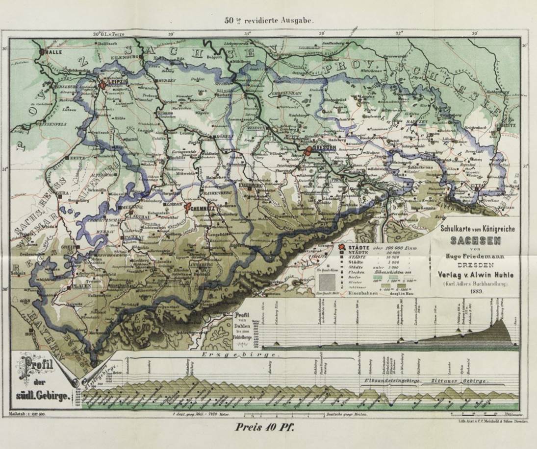
This
school map of Saxony clearly shows the Erzgebirge (Ore Mountains) on the
kingdom’s southern border with Bohemia (Austro-Hungarian Empire). The valleys
and streams that ran northward from these highlands provided much of the
waterpower for Saxony’s early industrialization. The more agricultural lowlands
in the north can also be seen.
Source: Hugo Friedemann, Schulkarte vom Königreiche
Sachsen, 50th rev.
ed. (Dresden: Verlag Alwin Huhle, 1889).
Copyright 2017 James Retallack. All rights reserved. This page is part of the Online Supplement to James Retallack, Red Saxony: Election Battles and the Spectre of Democracy in Germany, 1860-1918 (Oxford: Oxford University Press, 2017). ISBN 978-0-19-966878-6.